| Return to Bedside Manor Home Page |
Here are a couple of aerial pictures taken by the army. On the left is one taken in 1993, and on the right is one from 1970.
I think it is pretty interesting how much the area has built up since 1970. Click on the picture below to see a larger version
of any of the images below. You may have to scroll around to see it all, unless you have a large monitor set to a very high
resolution.

This next one is a picture from the mid-1970's, looking south, with Bedside Manor in the middle. You can see the Fire
Station and the Happy Church on the left side. Woodlake Apartments are now in the space at the bottom of the picture,
and you can just see the edge of what we used to call Lost Lake in the bottom middle of the picture. It was located where
the pond in Woodlake is now. The rows of houses that are now on both sides of Bedside Manor were built in 1978 and 1979. 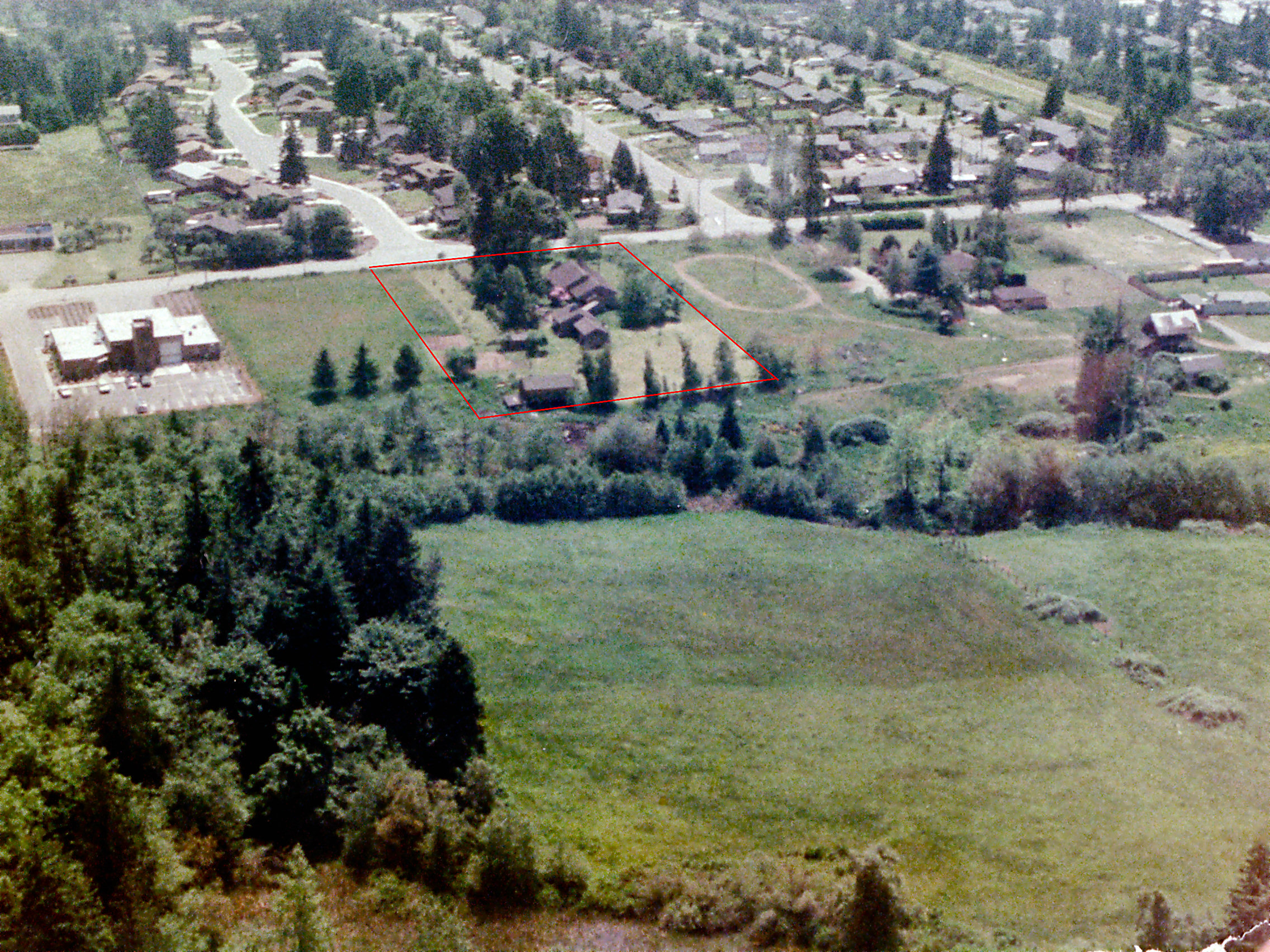
The next one was taken on the same day, looking north. Our house can barely be seen, hidden behind the big trees that
were taken down in 1993, after the Inauguration Day storm blew one of them down. On the upper left you can see what
we always called Weaver’s Pond. It is still there today, although it is not as inviting any more. The houses across NE 132nd
St. were built in 1972, so the pictures date to the mid-1970’s.
The last one, taken the same day, is looking more or less east. You can see the Kingsgate development in the background,
across the freeway.
Home Page | The WSDOT Story | History | Aerial Photos | Make a Comment | Contact Us